We’re asking contributors to put together their own collected observations like this one – and as always, if you’ve got an idea to pitch for The Interpreter, drop a line via the contact details on the About page.
Nothing is as it seems in Australia’s closest neighbour, Papua New Guinea. Just last month the United Nations Population Fund revised down its estimate of PNG’s population from 17 million to 11.8 million, which finally sits comfortably with the PNG government. That’s a walloping 5.2 million revision by the UN. And even then, no one really knows the exact number of people in the country.
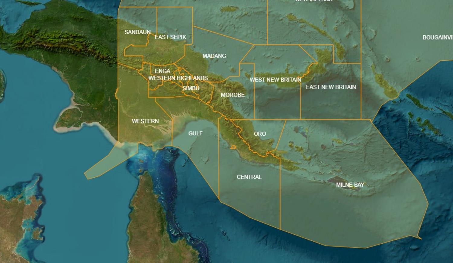
Another contentious issue is mapping. Before the elections last year, PNG rushed through seven new voting districts. Although the Electoral Commission released new district maps individually, it failed to publish a new national map. Now, thanks to the Australian National University’s CartoGIS department, we have a map that reveals an estimated size of the new districts.
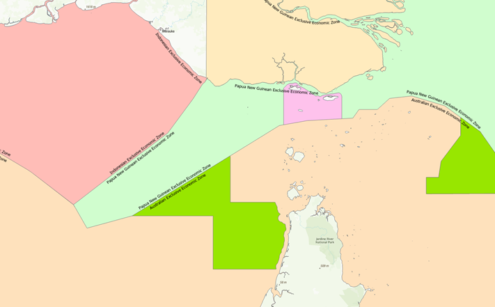
The map itself has a few quirks. PNG’s Exclusive Economic Zone (EEZ) is drawn weirdly – particularly in the south-west where PNG shares maritime borders with Australia and Indonesia.
Generally, EEZ boundaries are defined as up to a 200 nautical mile buffer from a nation’s territorial sea. According to this map, PNG owns a strip of ocean jutting out well into what might be considered Australian and Indonesian territory. This appears not to be a fault of PNG, but a consequence of how Australia and Indonesia’s EEZs and marine parks are drawn.

Finding an accurate map is important, particularly concerning security as Australia and the United States work toward security pacts with PNG. The United States signed a defence cooperation agreement with PNG in May, and Australia is close to putting pen to paper on one with PNG as well. PNG is courting other nations, too, with Narendra Modi (India), Joko Widodo (Indonesia), and Emmanuel Macron (France) all visiting Port Moresby in quick succession.
As geopolitical competition over PNG grows, so must the accuracy of knowledge about the country. Otherwise, all assessments will be founded on guesswork.


